This week the Parish Council approved the following for submission to the ongoing consultation.
National Grid Masterplans
Response of Roydon Parish Council, Norfolk, to National Grid Document: 8.4.12.2: Response to ISH2 Action Point 27 – Masterplans. Planning Inspectorate Reference: EN020027
Roydon Parish Council considers National Grid’s masterplan in relation to the Waveney Valley to be inadequate, poorly thought out and potentially damaging to sensitive landscapes in our village. It fails to understand the nature of the habitats, lanes and neighbourhoods it refers to, and the suggested works actually threaten the future of some of these habitats, including a Site of Special Scientific Interest and a nature reserve.
This suggests that National Grid have failed to do any credible research in relation to mitigation in the village, and has seen the preparation of the masterplan as nothing more than a tick-box exercise. National Grid needs to return to the drawing board.
We stress that the parish council considers properly thought out biodiversity enhancements and mitigation to be essential in relation to the pylons.
Turning to specific proposed remedies for the Waveney Valley.
Roydon Fen. National Grid proposes the planting of trees and hedgerows at Roydon Fen. But this is a rare wetland nature reserve, managed by Suffolk Wildlife Trust, where it’s important to control the spread of woodland to preserve the fen’s characteristics. What National Grid is proposing would risk damaging the habitat.
Wortham Ling. Similarly, National Grid proposes tree and hedgerow planting at the Ling – a Site of Special Scientific Interest composed of acid grassland and dry heath. The Grid’s proposal again completely fails to grasp the nature of the habitat they’re referring to. Tree planting would fundamentally alter and damage this rare SSSI habitat.
Snow Street. The Grid proposes green infrastructure improvements but the western half of the highlighted section is already heavily wooded and / or with hedgerows and we question what additional work could be undertaken. The eastern end is Brewers Green, a County Wildlife Site, which is already managed to protect and enhance specific habitats such as ponds and open grassland. There is no indication of what green infrastructure the Grid is thinking about, but activities such as a significant programme of tree planting would again be considered inappropriate as it could threaten the future of these specific habitats.
Route planning: The applicant states in the document that it “considers that appropriate mitigation has already been incorporated into the Project development through route selection, design development, adherence to relevant national policy and guidance including the Holford and Horlock Rules”. But, as Roydon Parish Council has stated in its submissions to National Grid and the Planning Inspectorate, the Holford Rules have been repeatedly ignored in relation to the village – particularly Holford Rule 3. One of the key ways it could have used design development to protect the Waveney Valley, the undergrounding option, was quickly dispensed with by the applicant.
The masterplan proposes little relevant mitigation in relation to the 50m pylons to the north of Snow Street, which impact a key view listed in the Diss and District Neighbourhood Plan as well as several popular footpaths. Neither is there any mitigation in relation to pylons impacting the Angles Way footpath in the valley, which they cross, or views of the Grade 1 listed St Remigius Church. The Grid’s suggestion that existing greenery protects views of the church is a falsehood.
The parish council points out that we were not consulted in relation to this masterplan. Perhaps if its staff had spoken to us, they would not have made the errors and proposed such potentially damaging solutions in this masterplan.
Norfolk County Council (Diss) Emergency Notice Temporary Traffic Regulation Order 2026 Section 14(2) of the Road Traffic Regulation Act 1984
Diss (AZ1011001519777-01) Notice
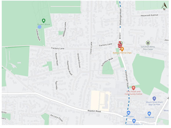
In accordance with the provisions of Section 14(2) of the Road Traffic Regulation Act 1984, the Norfolk County Council HEREBY GIVE NOTICE that owing to gas escape repair works the use by vehicles (of any class) of the B1077 Shelfanger Road from its junction with U76012 Factory Lane for 50 metres southwards (the “Road”) in the Town of Diss will be temporarily prohibited/restricted.
Alternative route is via: B1077 Shelfanger Road/ Diss Road/ Church Road/ Diss Road/ Mill Road/ The Street/ Short Green/ Mile Road/ Haugh Road/ New Buckenham Road/ Cake Street/ The Green Attleborough Road/ Station Road/ Connaught Road/ Queens Road, A11 Attleborough Bypass, B111 Shropham Road/ Church Road/ Market Street/ Garboldisham Road/ Harling Road Manor Road/ The Street, A1066 Diss Road/ Thetford Road/ Diss Road/ Low Road/ High Road Stanley Road, B1077 Denmark Road (Bressingham, Quidenham, New Buckenham, Roydon, Diss, Bridgham, South Lopham, Old Buckenham, Garboldisham, Heywood, Winfarthing, Attleborough, Shelfanger, Snetterton, Banham, North Lopham, Harling, Roudham and Larling).
The works promoter for this restriction/closure is: Cadent.
The closure/restriction is necessary because of the likelihood of danger to the public or serious damage to the Road or both.
The closure/restriction is anticipated to take place from 8th to 23rd June 2026 but the Road may continue to be closed/restricted until the 28th June 2026 where the closure/restriction is still required beyond the anticipated dates.
This Notice shall automatically revoke on the completion of the works / when the closure/restriction is no longer necessary or otherwise on the 28th June 2026 without further notice.
If necessary, this Notice may be extended for an additional 21 days by further Notice and/or for a maximum of 18 months from the date this Notice is effective by further Order.
Any existing restrictions or prohibitions within Orders made under the RTRA 1984 will become suspended where they conflict with the provisions of this Notice during the operation of this Notice.
A person who contravenes, or who uses or permits the use of a vehicle in contravention of the restriction/ closure imposed by the Order shall be guilty of an offence.
Penalty: £1000 maximum fine on conviction and/or endorsement for contravention.
Full details on the closure are available at https://one.network. Any enquiries that cannot be answered on the one.network website should be directed to the South Area Streetworks (Infrastructure Department) contactable by telephone at 0344 800 8020 or email at streetworks@norfolk.gov.uk
Dated this 16th day of June 2026.
Katrina Hulatt Director of Legal Services (nplaw) County Hall Martineau Lane Norwich NR1 2DH
Its back! Roydon Big Green week is set to return from the 8th – 13th June.
Join us for walks, talks and lots of fun throughout the week ending with a fantastic Community Picnic on Brewers Green on Saturday 13th June. Keep an eye on our socials for more information https://www.facebook.com/Roydondissparishcouncil
Roydon, Old High Road (Junction at A1066) – Road resurfacing
Norfolk County Council will be carrying out essential highway maintenance works on Old High Road, Roydon, starting on Wednesday 27 May 2026 for a duration of 2 days, with the restriction period ending on Thursday 28 May 2026
The work forms part of the Council’s Plane & Surface Scheme and includes resurfacing of the carriageway and reconstruction of sections of the footway. These works are essential to maintain the safety and quality of the road surface
Alternative Route: A1066 High Road, A1066 Stanley Road, B1077 Denmark Street, Roydon Road, Old High Road.
Access: Access to Manor Road will be maintained up to the points of closure via Brewers Green. Emergency access will be available at all times.
The County Council thanks people for their patience while this road resurfacing work is carried out.
The work which will cost £40,000 will be carried out by Norfolk County Council’s Infrastructure Department and their contractors.
For further information
Elanor Coe, Locality Designer, 0344 800 8020.
Up-to-date information about roadworks in Norfolk is available on the County Council website at www.norfolk.gov.uk/roadworks
If you need this report in large print, audio, Braille, alternative format or in a different language please contact 0344 800 8020 or textphone 0344 800 8011 and we will do our best to help.
Visitors and residents can now enjoy a significantly improved walking experience thanks to recent upgrades to Footpath 5 (FP5) and its junction with Footpath 4 (FP4).
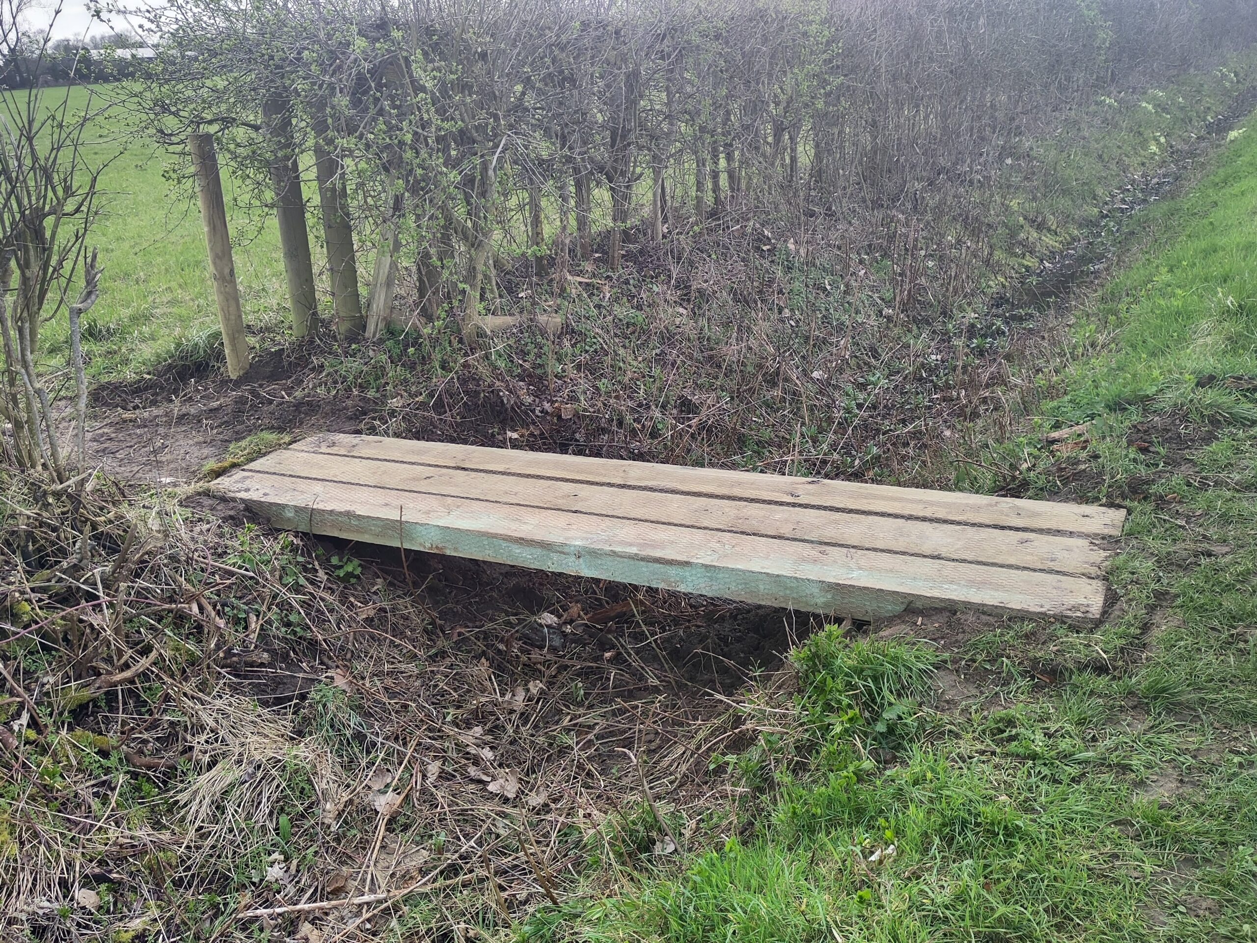
Norfolk County Council has installed a new Ligger Bridge at the crossing point between FP5 and FP4, providing a safer and more reliable route for walkers. This addition represents an important investment in the local footpath network, helping to ensure year-round accessibility.
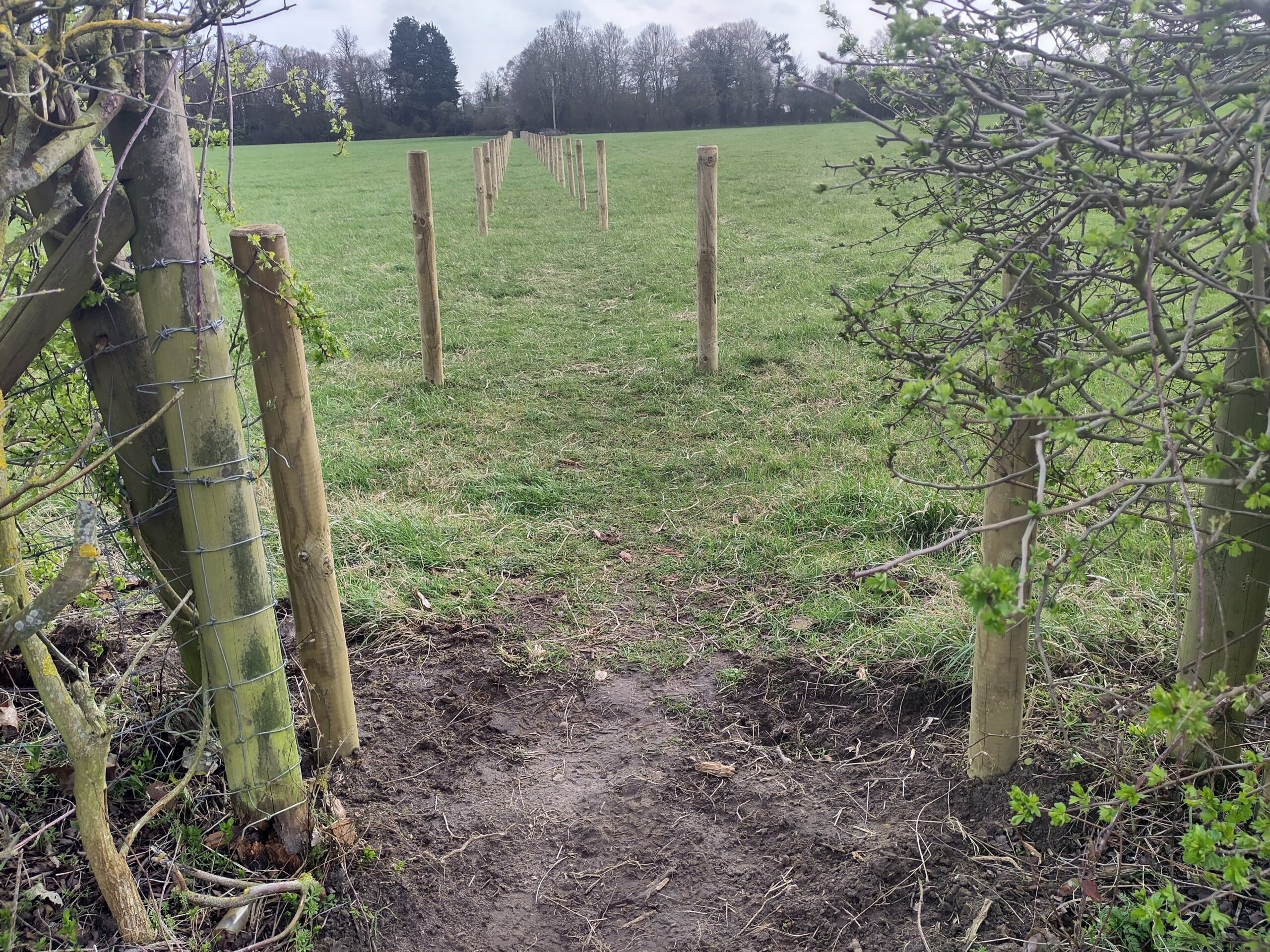
Further enhancements have been made along Footpath 5 by the landowner, whose contributions have greatly improved usability across the route. Fence posts have been installed to clearly define the path across the field, making navigation easier for walkers. In addition, stiles have been removed to allow more convenient access for a wider range of users, including those with dogs or limited mobility.
The section of the path running alongside nearby properties, leading from the field to Little Green, has also been cleared, creating a more open and welcoming route.
These collaborative efforts have resulted in a safer, more accessible, and more enjoyable walking environment for the whole community.
New Ligger BridgePicture shows removal of the stile
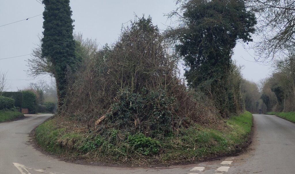
Roydon Parish Council is pleased to share that the area around the Brewers Green / Factory Lane triangle has recently been given a much-needed tidy-up.
The Parish Council would like to express its sincere thanks to the Norfolk County Council Highways Team for carrying out extensive hedge-cutting along these roads. The work was completed ahead of the start of bird nesting season, ensuring that the local environment and wildlife are both respected and maintained. 🐦🌼
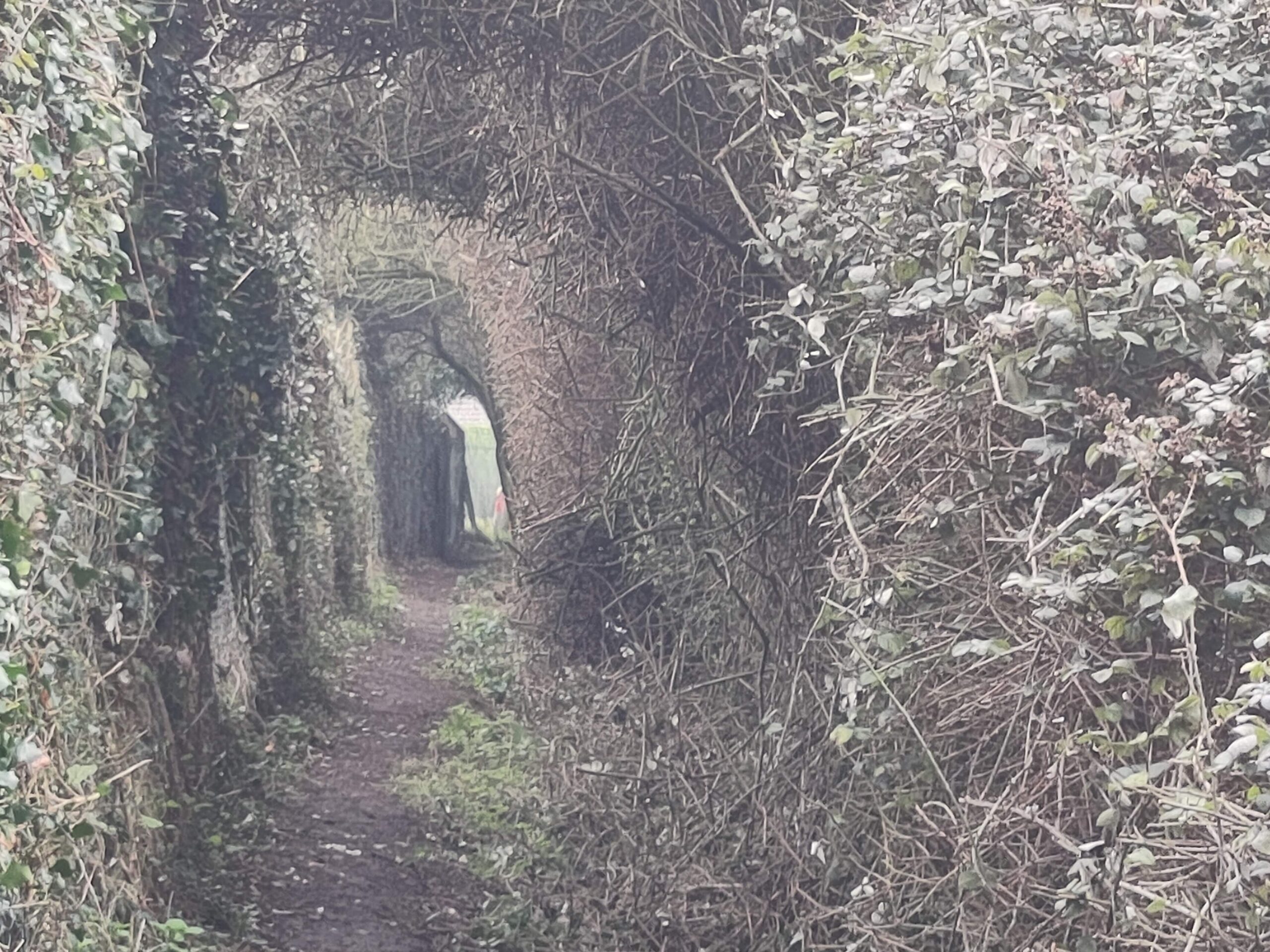
In addition, the team went the extra mile by cutting back the third side of the triangle — Footpath 18 (FP18) — bringing this popular walking route back to life for residents and visitors to enjoy once again. 🚶♀️🌳
The Parish Council extends its appreciation to everyone involved in helping to keep Roydon looking tidy, safe, and inviting for all. 💚
Apex of the Triangle cut backFootpath 18 cut backBrewers Green Lan cut back
Roydon Parish Council gave an oral presentation to the Planning Inspectorate examining National Grid’s proposal for a new line of 50-metre pylons between Norwich and Tilbury, during a hearing held today in Norwich.
The Council had previously submitted written objections to the scheme, but the presentation was an important opportunity to highlight the unique impact the proposal would have on Roydon. In our five-minute address, we emphasised that Roydon is the only village along the entire route that would be enclosed on three sides by pylons — a situation that National Grid’s current design completely overlooks. We also raised concerns that the proposal fails to follow established planning and design principles, including the Holford Rules, which are intended to minimise visual intrusion and protect the landscape.
Roydon was strongly represented at the hearings, with several residents also speaking passionately about the wider implications of the route — including its effects on the Waveney Valley, the natural environment, and the wellbeing of local people.
A copy of the Parish Council’s presentation is available to read here Roydon Oral Submission